 Dataregister Rijkswaterstaat

Type of resources
Topics
Provided by
Years
Representation types
Update frequencies
status
online bronnen
Resolution
-
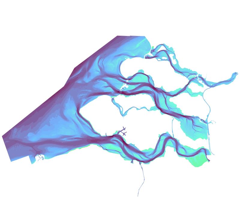
Het Zeeland grid is een samengesteld dieptegrid wat gebaseerd is op de diepte informatie in de Inland ENC van Zeeland. Het grid is samengesteld uit +/- 1150 lodingen. Het daadwerkelijk aantal lodingen verschilt per uitgave van het Zeeland grid. De naukeurigheid is afhankelijk van het type loding ter plaatse, de meest nauwkeurige loding is de multibeam loding. Deze voldoen aan de IHO special order norm. Het gehele grid is geproduceerd in UTM(31) projectie en vervolgens getransformeerd naar R.D. De verticale referentie is het N.A.P. Door de transformatie van UTM naar RD treedt er een extra afwijking op in de bodemhoogte. Deze afwijking is nagenoeg random en voor iedere gridcel anders. Deze extra afwijking in de hoogte ligt voor 99% van het grid binnen de 15 cm. Bij een bodem met een zeer steile helling kan de afwijking oplopen tot 2m. Cellen met een zeer afwijkende diepte zijn altijd geisoleerde gridcellen. In de omliggende gridcellen is de afwijking veel kleiner waardoor er wel een juist bodembeeld zichtbaar blijft. Het Zeelandgrid kan gebruikt worden als indicatief grid. Het is niet geschikt voor navigatie, voor controle van andere lodingen of voor volumeberekeningen. Dit door de transformatie van UTM31 naar RD.