 Dataregister Rijkswaterstaat
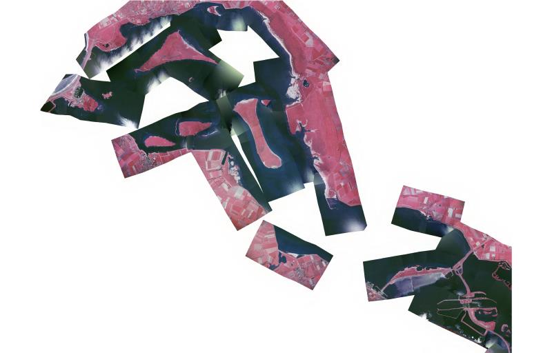
Orthofotomozaiek Grevelingen 2005
infrarood orthofoto voor vegetatie kartering
Standard
Basis
- Date (Creation)
- 2005-12-31
- Unique resource identifier
- 433666f3-dd62-4406-981e-a79c8d9316e9
- Status
- Completed
- Metadata language
- Nederlands; Vlaams
- Keywords
-
- Luchtfoto
- geomorfologie
- MWTL
- N2000
- platen
- slikken
- schorren
- kwelders
- intergetijdegebied
- ecotopen
- hydrodynamiek
- KRW
- Natuur en Milieu
- biologische monitoring
- Use limitation
- Geen beperkingen
Legal constraints
- Use limitation
- Geen beperkingen
- Access constraints
- Other restrictions
- Use constraints
- Other restrictions
- Other constraints
- Geen beperkingen
Security constraints
- Classification
- Unclassified
Owner
Rijkswaterstaat
-
Servicedesk Data
(
Verstrekker
)
Derde Werelddreef 1
,
Delft
,
Zuid-Holland
,
3000 AN
,
Nederland
https://www.rijkswaterstaatdata.nl/
))
DataQuality
- Hierarchy level
- Dataset
- Lineage
- Gemaakt door Centraal Bureau voor de Statistiek op basis van luchtfoto's.
Metadata
- Metadata language
- Nederlands; Vlaams
- Hierarchy level
- Dataset
Point of contact
Rijkswaterstaat
-
Servicedesk Data
(
Contactpunt
)
Derde Werelddreef 1
,
Delft
,
Zuid-Holland
,
3000 AN
,
Nederland
https://www.rijkswaterstaatdata.nl/